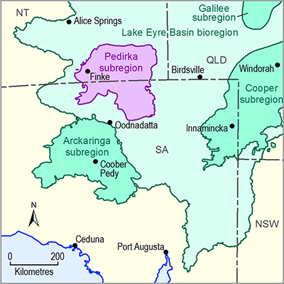
The Pedirka subregion is situated in Australia’s arid zone where highly variable rainfall, characterised by long periods of no rain and occasional heavy rainfall events (Allan 1985; Croke et al., 1999; see 1.1.2.3), coupled with low soil fertility and localised soil differentiation are the dominant physical environmental drivers of ecosystem composition (Morton et al., 2011).
The Interim Biogeographic Regionalisation for Australia (IBRA) identifies biogeographic regions and subregions based on common climate, geology, landform, native vegetation and species information. The Pedirka subregion contains three IBRA bioregions: Finke, Stony Plains and Simpson Strzelecki Desert (Table 5; Figure 37). The Simpson Strzelecki Desert is the predominant land system; it mainly comprises vast dunefields.
The Pedirka subregion has not been cleared of native vegetation, however, the natural biodiversity and condition has been altered through changes in burning regimes, introduction of pastoral grazing, pest plants and animals, additional watering points and free flowing bores, changes in water pressure to GAB springs and changes to surface water flow through construction of infrastructure (DEH & SAAL NRMB 2009).
The region has undergone gradual desertification over past millennia (Cohen et al., 2011; Magee et al., 2004) leading to the isolation of aquatic ecosystems (Gotch, 2013b). Aquatic ecosystems, including floodplains, floodouts, springs and ephemeral watercourses provide critical refuge and vital habitats for many species, including aquatic and terrestrial species (McNeil et al., 2011). Ecological processes are influenced by high levels of disturbance and variability driven by the variable arid climate. Large floods occur infrequently but drive spectacular booms in biotic production in the Lake Eyre Basin (LEB) (Kingsford 1999; Bunn et al., 2006). Clusters of smaller floods prolong waterbody persistence and provide an increased opportunity for dispersal between habitats compared with isolated flood events (Puckridge et al., 2000). Flood clusters increase the extent of the second and follow-on floods and produce a cumulative response from aquatic biota (Puckridge et al., 2000; Reid et al., 2010). During extended dry periods, aquatic ecosystem-dependent species exist either in highly fragmented sub-populations in isolated refugia, or as desiccant resistant propagules (e.g. eggs or seeds), or by reducing their productivity. When sufficient rainfall events occur, the surviving sub-populations emerge, disperse to other habitats, mix with other sub-populations and rebuild their populations. Within the Pedirka subregion there are no known permanent aquatic ecosystems, however the Great Artesian Basin (GAB) springs at Dalhousie just beyond the southern boundary of the subregion (and dependent on recharge zones within the subregion (Fulton et al., 2013)) include permanent pools and are estimated to have been active for between one and two million years (Kreig 1989). These evolutionary refugia support many short-range endemic species (Fensham et al., 2011) and relict species that would have been more widespread under past climatic conditions (McNeil et al., 2011b; Noack 2005; Davis et al., 2013; Gotch 2013). The community of species dependent on discharge from the GAB is listed as an endangered ecological community under the Environment Protection and Biodiversity Conservation Act 1999 (Cth) (EPBC Act) with reductions in spring flow from groundwater development being one of the main threats (Fensham et al., 2010).
The national approach to identifying High Ecological Value Aquatic Ecosystems (HEVAE) is based on multiple criteria: diversity, distinctiveness, vital habitat, naturalness and representativeness (AETG 2012b). In a trial application of the HEVAE criteria in the LEB, Kati Thanda – Lake Eyre, into which the Macumba catchment drains, and Dalhousie Springs were the only two aquatic ecosystems in the entire LEB to score very high in three HEVAE criteria (Hale et al., 2010).
Table 5 IBRA bio regions and IBRA subregions with a significant portion occurring in the Pedirka subregion
Source: Gillam and Urban (2013, p. 25–27)
Figure 37 Interim Biogeographic Regionalisation of Australia regions and subregions
Figure 38 Mapped vegetation associations for the Pedirka subregion

Product Finalisation date
- 1.1.1 Bioregion
- 1.1.2 Geography
- 1.1.3 Geology
- 1.1.4 Hydrogeology and groundwater quality
- 1.1.5 Surface water hydrology and surface water quality
- 1.1.6 Surface water – groundwater interactions
- 1.1.7 Ecology
- Citation
- Acknowledgements
- Contributors from the Government of South Australia
- Contributors to the Technical Programme
- About this technical product


