- Home
- Assessments
- Bioregional Assessment Program
- Pedirka subregion
- 1.1 Context statement for the Pedirka subregion
- 1.1.5 Surface water hydrology and surface water quality
Summary
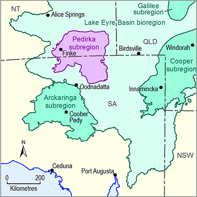
The Pedirka subregion of the Lake Eyre Basin is situated around the boundary of the NT and SA, and contains the most downstream part of the Finke catchment in the west of the subregion and intersects the Macumba catchment in the southern portion of the subregion. The extreme north of the Pedirka subregion also contains the lower floodout of the Hale River. The majority of the subregion is sandy desert, with the Simpson Desert covering more than half of the subregion to the east and the Pedirka Desert covering the south-western extents (Figure 30).
Understanding the ecohydrology of ephemeral to intermittent arid-zone river systems is greatly hindered by the paucity of hydrological data describing both individual flow events and the long term flow regimes in particular rivers. The site with the highest quality quantitative data in the Pedirka subregion is Eringa Waterhole, located on Lindsay River in the Macumba catchment, where only 17 months of measurements have been recorded. The data collected indicate the presence of shallow, high quality groundwater and suggest that the local flow regime is similar to that of the Neales-Peake (Arckaringa subregion) and flow events may occur around once a year. Observational evidence of the lower reaches of the Finke River catchment and the Finke Floodout indicate that large flow events, with annual recurrence intervals of around 10 years or more, are necessary to fully inundate the floodout. In addition, these large flows have been determined to be of importance for Great Artesian Basin (GAB) recharge as an area near Finke Community, immediately upstream of the Finke Floodout, has been identified as a key GAB recharge zone.
Smaller flow events in the lower reaches can fill waterholes, and may contribute to the persistence of the interdunal wetlands of the Finke Floodout subsequent to initial inundation created by a large river flow. Local flows from tributaries that feed directly into the floodout area may make a similar contribution to surface aquatic ecosystems. No data concerning the Hale River Floodout have been collected.

Product Finalisation date
- 1.1.1 Bioregion
- 1.1.2 Geography
- 1.1.3 Geology
- 1.1.4 Hydrogeology and groundwater quality
- 1.1.5 Surface water hydrology and surface water quality
- 1.1.6 Surface water – groundwater interactions
- 1.1.7 Ecology
- Citation
- Acknowledgements
- Contributors from the Government of South Australia
- Contributors to the Technical Programme
- About this technical product
