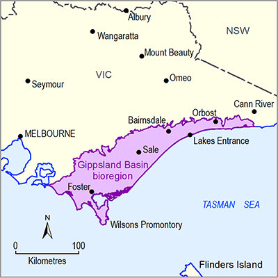
The South Gippsland river region is comprised of relatively small, dynamic and independent river systems flowing from the Strzelecki Ranges in the north to the southern Victorian estuarine and coastal environments (Sinclair Knight Merz, 2012). The river region area is 6677 km2 and includes the unregulated Tarra, Agnes, Albert/Jack, Franklin, Tarwin and Powlett rivers, and Merriman Creek. Sinclair Knight Merz (2012) identified that rivers in the upper river region have sustained stream flow for the majority of the year while in the mid to lower river region, stream flow is sustained for less than 50% of the time. The modelled streamflow proportion of depletion and lag rate, following groundwater extraction, indicate the rivers of South Gippsland are moderately connected to adjoining aquifers (Sinclair Knight Merz, 2012).
The Cretaceous-aged metasediments of the Strzelecki Group and Paleozoic-aged bedrock outcrop in the north of the river region, forming fractured rock aquifers with local flow paths and localised alluvial valley infill sequences. In the highlands Lower Tertiary volcanics have produced layered aquifers. The Tertiary Latrobe Valley Coal Measures and Boisdale Formation aquifers form regional aquifer flow systems in the lower reaches of the river region (Sinclair Knight Merz, 2012).
The Tarra River has the highest water yield of the river region averaging 42% of total annual flows of all rivers within South Gippsland (Sinclair Knight Merz, 2012). Baseflow at the main Tarra River gauge of Yarram has declined by 75% since the 1950s (Sinclair Knight Merz, 2006). Generalised Additive Model (GAM) analysis of baseflow trends between the late 1960s and the present, combined with analytical calculations, indicates a baseflow decline of about 40% over the critical low-flow months of February and March from about 12 ML/day to 8 ML/day (Evans, 2007). The Tarra River basin has been the focus of several investigations of the occurrence, extent and magnitude of surface water and groundwater interactions at river basin and river sub-basin scales (GHD, 2009). Limitations of data and methods used for these investigations have restricted the quantification of surface water and groundwater interactions (GHD, 2009). Sinclair Knight Merz (2006) note that prior studies show significant reductions in baseflow associated with regionally declining groundwater levels. Sinclair Knight Merz (2006) report that the reduction in baseflow was likely to be mainly caused by a reduction in rainfall over this period, with circumstantial evidence suggesting that the decline in baseflow may also be due to groundwater extraction, to a lesser extent. However, due to data constraints, previous analyses were not conclusive and warranted further data collection (Sinclair Knight Merz, 2006).
In the geological Tarwin Basin and Alberton Depression; Nicol (2010) noted less than 50% baseflow component in streams across the southern aspect of the Strzelecki Ranges. Groundwater in the Tarwin Basin primarily discharges to the Tarwin River system and shallow depressions (Nicol, 2010; Pratt, 1985). A groundwater divide restricts flow in or out of the geological basin, subsequently no long groundwater flow paths contribute to net baseflow discharge in the Tarwin Basin. The Tarwin River gauges record relatively low baseflow indices (less than 50%). Pratt (1985) tentatively calculated a baseflow discharge of 6200 ML/year to the west branch of the Tarwin River.

