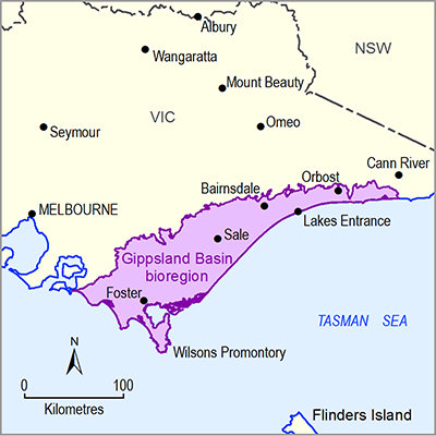
The Gippsland Basin bioregion is located in south-east Victoria (Figure 3). It covers an area of approximately 14,636 km². This bioregion is defined by the onshore extent of the geological Gippsland Basin and includes the brown coal mines of the Latrobe Valley in the vicinity of Morwell and Traralgon. The Gippsland Basin Bioregional Assessment is focused on the risk and impacts to water dependent assets potentially arising from onshore resources of coal seam gas and coal mining, which subsequently constrains the bioregion to the onshore reaches of the geological Gippsland Basin. Approximately 70% of the geological Gippsland Basin occurs offshore.
Figure 3 Gippsland Basin bioregion
Key river basins in the Gippsland Basin bioregion include the South Gippsland, La Trobe, Thomson, Mitchell, Tambo and Nicholson, Snowy, and parts of East Gippsland river basins (Figure 4). All key river basins drain seaward, many via Ramsar-listed wetlands including Gippsland Lakes and Corner Inlet.


