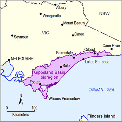
Around 8% of the water extracted for towns, industry and agriculture in the Gippsland Basin bioregion is sourced from groundwater (DSE, 2011). The development of Gippsland’s groundwater resources commenced in the early 1900s, with the development of the Macalister, Mitchell River and Yarram irrigation districts. Large-scale aquifer depressurisation for coal mining began in the 1960s. Groundwater from shallow and deep aquifers either supplies or supplements the water supply to a number of towns across Gippsland including Sale, Boisdale, Briagolong, Wurruk and Yarragon. Sale’s town water supply has been solely sourced from groundwater since 1970 (Schaeffer, 2008). Groundwater has also become increasingly investigated as a contingency water supply for other towns throughout the Gippsland Basin (e.g. Thorpdale) (Gippsland Water, 2012).
There are about 164 GL of licensed groundwater entitlements in Gippsland. In any managed groundwater area, the licensed entitlement is capped at the permissible consumptive volume (PCV). The total PCV for the Gippsland Basin bioregion is about 176 GL (see Table 16).
The Yallourn, Morwell and Loy Yang open-cut coal mines hold licences to pump about 45 GL/year of groundwater to drain and stabilise the mines. Average annual groundwater extraction at the mines is 30 GL/year (DSE, 2011). The total extracted groundwater volume for the July 2012 to June 2013 period was 28.5 GL (GHD, 2013). This water is typically extracted from the middle aquifer system and the lower aquifer system.
Offshore oil and gas production extracts additional water from the Latrobe Group aquifer (the ‘lower’ groundwater system). The effective volume of oil, gas and groundwater extracted offshore is estimated at 100 GL/year since the early 1990s (DSE, 2011).
In general, water levels in the confined and semi-confined aquifers of the Gippsland Basin have been falling for the past few decades by around 0.5 m/year in parts of the Boisdale Formation, around 0.5 m/year in the Balook Formation and around 1.1 m/year in the Latrobe Group aquifers, while water levels in the shallow Quaternary age aquifers have remained steady.
Groundwater management is split into groundwater catchment areas:
- Central Gippsland groundwater catchment
- Moe groundwater catchment
- Seaspray groundwater catchment
- East Gippsland groundwater catchment
- Tarwin groundwater catchment.
Within these groundwater catchment areas, where there is more intensive groundwater use, groundwater is managed within groundwater management units (GMUs) called either water supply protection areas (WSPAs) or groundwater management areas (GMAs). Groundwater is managed in these GMUs under conditions set out by local management plans for each GMU. GMUs are defined by their depth and geographical boundaries which means that there may be more than one GMU overlapping in some areas. PCVs and trading rules are the principal management tools set out by these plans. Table 16 provides a summary of the management areas. Figure 32 shows a map of the management areas. PCVs and licensed extraction volumes are included in Table 16.
Areas within groundwater catchments but outside a GMA or WSPA are managed under local management plans. No PCVs are set for local management plans outside WSPAs and GMUs. The following local management plans are in place:
- Central Gippsland and Moe Groundwater Catchments (areas outside of GMUs) Local Management Plan
- East Gippsland Groundwater Catchment (areas outside of the Orbost GMU) Local Management Plan
- Seaspray Groundwater Catchments (areas outside of GMUs) Local Management Plan
- Tarwin Groundwater Catchments (areas outside of GMUs) Local Management Plan.
All new licensed bores and any existing licensed bore with a licensed extraction volume of greater than 10 ML/year are metered.
Table 16 Water supply protection areas (WSPA) and groundwater management areas (GMU) within the Gippsland Basin bioregion
Source Southern Rural Water (2010; 2014a; 2014b; 2014c; 2014d)
Data: Department of Environment and Primary Industries (Dataset 8), Department of Environment and Primary Industries (Dataset 9)


