1.1.2.2.1 Population
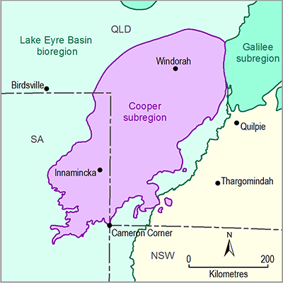
The Cooper subregion is sparsely populated. Very little census data is available for the area of the subregion as it contains no ‘Significant Urban Centres’ and the entirety of the subregion is reported within the ‘Balance of State’ for census data. The mesh block is the smallest geographic area on which the Australia Bureau of Statistics (ABS) reports data and only usual residential population and number of dwellings are reported at this scale. A total of 37 mesh blocks lie within or partly within the Cooper subregion boundary. In 2011 the total population of these mesh blocks was 1032, and 626 dwellings were recorded (Australian Bureau of Statistics, 2013).
Figure 8 Cooper subregion local government areas, towns and localities
Source: Australian Bureau of Statistics (2013)
1.1.2.2.2 Economic activity
The local government areas (LGAs) of the Cooper subregion are: Barcoo Shire, Quilpie Shire, and Bulloo Shire, with small amounts of Diamantina Shire and Longreach Regional in Queensland, and part of the Outback Areas Community Development Trust in SA (Figure 8). The Unincorporated Far West LGA in NSW covers such a small amount of area in the Cooper subregion it has not been included in the employment statistics below.
Industry of occupation is shown in Table 4 . As demonstrated by the township of Moomba with no permanent population but a large fly-in fly-out workforce, mining is the largest employer for the LGAs of the subregion at 30.1%, followed by manufacturing (15.2%), agriculture, forestry and fishing (9.5%) and construction (7.5%) (Australian Bureau of Statistics, 2013).
Table 4 Occupation categories in local government areas within the Cooper subregiona
Data: Australian Bureau of Statistics (2013)
aThe NSW part of the subregion is not included as it represents only a very small part of the subregion
bThe LGA of Unincorporated SA covers a large area and only a small amount (which includes Innamincka and Moomba) of it lies within the Cooper subregion. This, combined with a large transient workforce, is the reason the employment numbers are so large compared to the population.
1.1.2.2.3 Land use
Most of the land in the subregion is used for natural vegetation grazing but there are also significant areas of nature conservation (see lists below of protected areas and wetlands) (Figure 9). The subregion also contains an area of mining and intensive gas treatment, storage and distribution at Moomba, a gas exploration and processing town with no permanent population.
Areas within the Cooper subregion that are listed in the Collaborative Australian Protected Area Database (Wang, Dataset 10):
- Innamincka Regional Reserve
- Strzelecki Regional Reserve
- Bulloo Downs Nature Refuge (in one of the subregion’s outliers)
- Welford National Park
- Coongie Lakes National Park
- Lower Dinner Creek Nature Refuge
- Sturt National Park (in NSW, so only a very small amount lies in the Cooper subregion).
Wetlands within the Cooper subregion that are listed in DIWA (Department of the Environment, Dataset 6):
- Strzelecki Creek Wetland System
- Lake Cuddapan
- Cooper Creek Overflow Swamps – Windorah
- Cooper Creek Overflow Swamps – Nappa Merrie
- Cooper Creek Overflow Swamps – Wilsons River Junction
- Bulloo Lake (in one of the subregion’s outliers)
- Coongie Lakes Ramsar site
- Lake Yamma Yamma
- Lake Pinaroo (Fort Grey Basin) Ramsar site (only a very small area is within the Cooper subregion).
Several threatened ecological communities of native species dependent on the natural discharge of groundwater from the Great Artesian Basin from the Lake Frome Supergroup are just outside the Cooper subregion on the edge of Lake Blanche and further south near Lake Callabonna. These communities are listed as endangered under the Commonwealth’s Environmental Protection and Biodiversity Conservation Act 1999.
Figure 9 Cooper subregion land use
Data: Australian Bureau of Agricultural and Resource Economics and Sciences (ABARES) (Dataset 1)
1.1.2.2.4 Indigenous heritage
The Cooper subregion is within the Eyre region for Indigenous language groups (Horton, 1994) and has the following tribal or language groups:
- Birria
- Wangkumara
- Yandruwandha
- Yawarawarka
- Karuwali.
There are native title claims covering large portions of the subregion and a number of Indigenous Land Use Agreements (ILUAs) in place. ILUAs are negotiated agreements between native title claimants and others about the use and management of lands and waters and were introduced by amendments in 1998 to the Commonwealth’s Native Title Act 1993. An ILUA can be negotiated and registered separately to a native title determination.
At the time of writing there were 14 ILUAs in the Cooper subregion (Commonwealth of Australia, 2014):
- Boonthamurra Opal ILUA
- Innamincka Township ILUA
- Yandruwandha/Yawarrawarrka Petroleum Conjunctive ILUA
- Yandruwandha/Yawarrawarrka Innamincka Pastoral ILUA
- Yandruwandha/Yawarrawarrka Tinga Tingana Pastoral ILUA
- Yandruwandha/Yawarrawarrka White Catch Pastoral ILUA
- Yandruwandha/Yawarrawarrka Bollards Lagoon Pastoral ILUA
- Yandruwandha/Yawarrawarrka Gidgealpa Pastoral ILUA
- Yandruwandha/Yawarrawarrka Merty Merty Pastoral ILUA
- Coongie Lakes National Park ILUA
- Strzelecki Regional Reserve ILUA
- Innamincka Regional Reserve ILUA
- Yandruwandha Yawarrawarrka Fishing ILUA
- Yandruwandha/Yawarrawarrka Cordillo Downs Pastoral ILUA.


