Geological and Bioregional Assessment Program factsheets
The Geological and Bioregional Assessment (GBA) Program has prepared a series of short factsheets to provide summary information on GBA program results, methods, field investigations and research. This material has all been used to underpin the program’s assessments in each GBA region.
GBA Program factsheets
These factsheets provide a summary of the key findings and methods of the GBA Program. More detailed information is available on the GBA region assessment pages and the GBA Explorer.
| GBA Program factsheet | Relevant Region |
|---|---|
Impact Assessment for the Beetaloo GBA region |
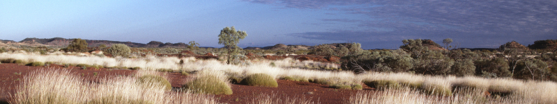
Beetaloo |
Impact Assessment for the Cooper GBA region |
Cooper |
Introduction to causal networks |
All |
GBA Program field investigation factsheets
The GBA Program is underpinned by field investigations, research and analysis to address knowledge gaps in each of the GBA regions. These studies provide critical evidence for the causal network assessments that are available in the GBA Explorer. Many of the studies are described in peer-reviewed journals and reports, which will be publicly available once published. The factsheets here provide a summary of the studies and the results.
For a different document format, please contact us.
|
Factsheet Number |
GBA Program technical factsheet tile |
Download |
Relevant Region |
|---|---|---|---|
| 1 |
Actual evapotranspiration in the Cooper Creek floodplain: transmission losses and groundwater rechargeThis study investigated the water balance of the Cooper Creek alluvium using actual evapotranspiration and remote sensing. This allowed areas to be classified by their water source, including open water, riparian areas, floodplain and rain-fed areas. |
Cooper | |
| 2 |
Assessing hydraulic fracture risks to groundwaterThis investigation determined an approach to identifying risks that hydraulic fracturing activities may pose to groundwater resources, with a focus on the Cooper GBA region. |
Cooper | |
| 3 |
Assessment of groundwater quality from a possible leak of a flowback storage tank from shale gas operationsThis study used predictive modelling to determine the natural dilution processes that could prevent spread of chemicals from a hypothetical leak out of a flowback storage tank during shale gas operations. |
All | |
| 4 |
Beetaloo GBA recharge pathways – Sinkholes and their influence on recharge to aquifersThis project aimed to improve understanding of the major pathways that groundwater takes to reach aquifers in the Beetaloo GBA region, with a focus on the role of sinkholes |
Beetaloo | |
| 5 |
Beetaloo GBA recharge pathways – SummaryThis project aimed to improve the understanding of the major pathways that groundwater takes to reach aquifers in the Beetaloo GBA region. The summary looks at the three major pathways that water can take to reach aquifers in the region; 1) through the Carpentaria basin; 2) through sinkholes, and; 3) via shallow or perched aquifers. |
Beetaloo | |
| 6 |
Beetaloo GBA recharge pathways – Geology of the Carpentaria Basin and Cenozoic sedimentsThis project aimed to detail major geological factors that may influence recharge from rainfall to aquifers, with a focus on travel through the Cambrian Limestone Aquifer. |
Beetaloo | |
| 7 |
Characterising the connectivity between permanent waterholes and groundwaterThis investigation sought to determine the connectivity between groundwater and a subset of permanent waterholes within the area prospective for unconventional gas resource developments in the Cooper GBA region. |
Cooper | |
| 8 |
Characterising the connectivity between the Cooper Basin, Great Artesian Basin and shallow aquifersThis investigation sought to determine the connectivity between groundwaters in the Cooper Basin, Great Artesian Basin (GAB) and shallow aquifers and whether there is mixing of fluids from different aquifers. |
Cooper | |
| 9 |
Application of the chemical screening frameworkA chemical screening framework was developed based on modelling solute transport between unsaturated and saturated zones. This approach was used to determine the likelihood of chemicals reaching groundwater in harmful concentrations to the environment if an accidental release occurred. |
All | |
| 10 |
Groundwater sampling in the Cooper, Eromanga and Lake Eyre basinsThis investigation collected groundwater samples from the Cooper, Eromanga and Lake Eyre basins to provide baseline hydrochemistry and water quality data for various aquifers and hydrocarbon reservoirs in the Cooper GBA region |
Cooper | |
| 11 |
Environmental fate of hydraulic fracturing chemicalsThe GBA program developed a generic risk assessment estimate of natural dilution of chemicals associated with hypothetical and accidental leakage of chemicals used for shale and tight gas exploration to groundwater. The approach was applied to both the Cooper and Beetaloo GBA regions to determine quantitative risks to water and the environment |
All | |
| 12 |
Environmental tracer composition in aquifer rocks in the Cambrian Limestone Aquifer (CLA)Field investigations were undertaken to characterise groundwater composition of the Cambrian Limestone Aquifer (CLA). The CLA is a key water resource associated with the potential Beetaloo Sub-basin gas development. |
Beetaloo | |
| 13 |
Flood inundation modelling for Cooper Creek floodplainA 32,000 km2 hydrodynamic flood inundation model was developed for the Cooper Creek and its floodplain to investigate whether an increase in surface infrastructure associated with gas resource development could impact the flood regime of ecologically important waterholes and wetlands along the Cooper Creek. |
Cooper | |
| 14 |
Gas extraction and vegetation conditionThis investigation undertook analysis to determine if existing gas production activities have had a measurable impact on the condition of vegetation cover across the Cooper GBA region. |
Cooper | |
| 15 |
Groundwater recharge across the Cambrian Limestone AquiferThis investigation sought to quantify groundwater recharge over the entirety of the Cambrian Limestone Aquifer using chloride mass balance, baseflow separation and remotely-sensed water balance estimates. |
Beelaloo | |
| 16 |
Has development impacted flood characteristics?An investigation using remote sensing to determine if existing human development on the Cooper Creek floodplain has altered flood characteristics. |
Cooper | |
| 17 |
Hydrochemistry, 18O, 2H and radon time series of the Mataranka SpringsAn investigation into the origin of water flowing to the culturally important Mataranka Springs |
Beetaloo | |
| 18 |
Modelling of potential hydraulic (groundwater) impact pathways in the Beetaloo GBA regionGroundwater flow models were used to estimate potential hydraulic impacts (changes in groundwater pressures and flows) resulting from future shale gas extraction activities in the Beetaloo GBA region. |
Beetaloo | |
| 19 |
Groundwater recharge process in the Beetaloo Sub-basinThis study undertook water sampling for environmental tracers to improve our understanding of the regional recharge processes in the Beetaloo GBA region. |
Beetaloo | |
| 20 |
Regional tracer results in the Beetaloo Sub-basin and the Cambrian Limestone AquiferThe project investigated the regional flow system of the Cambrian Limestone Aquifer which is an important groundwater source in the Beetaloo GBA region extending over 1500 km and across three geological basins. |
Beetaloo | |
| 21 |
Revising the geology of aquifers in the Cenozoic Lake Eyre Basin in the Cooper GBA regionThis investigation analysed drill logs of existing petroleum wells to improve the understanding of the geological properties of shallow near-surface aquifers in the Cooper GBA region. |
Cooper | |
| 22 |
Seismic surveysA review of existing seismic acquisition datasets and technologies to determine potential future environmental disturbances from seismic acquisition in the Cooper GBA region. |
Cooper | |
| 23 |
Structural flow implications for unconventional resources exploration, Beetaloo sub-basin case study (Northern Territories, Australia)This investigation uses imaging of new seismic and electro-magnetic data to assess the potential for natural connections between unconventional gas resources, aquifers and the surface at a basin-scale in the Beetaloo Sub-basin. |
Beetaloo | |
| 24 |
Water quality risk assessment from use, handling, and storage of chemicals and flowback at onshore gas operations in the Beetaloo Sub-basinA qualitative risk assessment was carried out of possible events that might impact water quality from the use, handling and storage of chemicals used in gas extraction from the Beetaloo Sub-basin. |
Beetaloo | |
| 25 |
Groundwater sources to the Mataranka Springs ComplexAn investigation of the origins of the water at the Mataranka Springs complex. Spring and groundwater samples were collected in October 2019 (end of the dry season) and environmental tracers were analysed. Tracers provide information on groundwater flow paths, age and source. |
Beetaloo | |
| 26 |
Using natural capital accounting to track changes to ecosystem extent and conditionThe GBA Program compiled opening accounts or baseline ecosystem extent and condition accounts, for the Beetaloo and Cooper GBA regions. This provides a basis for ongoing assessment of environmental change at a regional scale as the gas industry develops. |
All | |
| 27 |
Modelling persistence of biodiversity at a regional scaleThis investigation assessed how the capacity of habitat to support biodiversity has changed in the Beetaloo and Cooper GBA regions over the past two decades |
Cooper | |
| 28 |
Development scenarios for unconventional gas resource developmentAn investigation into what unconventional gas resource development in the Beetaloo and Cooper GBA regions may look like over the next 50 years. |
All | |
| 29 |
Testing new remote sensing developments for the monitoring of protected matters in the Beetaloo GBA regionThis investigation developed a remote sensing approach for assessing changes in habitat condition for key areas in the Beetaloo GBA region that are of potential biodiversity value. |
Beetaloo – additional studies | |
LiDAR Survey FactsheetThis factsheet explains what Light detection and ranging (LiDAR) measures and describes the collection of the Cooper Creek floodplain LiDAR dataset for the Cooper GBA region |
Cooper | ||
Beetaloo baseline ecology programThe objective of this program was to compile a comprehensive baseline dataset of terrestrial and aquatic biodiversity distribution in the Beetaloo GBA region. The program has been developed in consultation with NT DENR to ensure that it informs the broader Strategic Regional Environmental and Baseline Assessment (SREBA). |
Beetaloo – additional studies | ||
Cooper Fieldwork FactsheetField observations and measurements of surface waters and groundwaters from properties across the Cooper GBA region were undertaken to help the GBA Program to better understand water resources and their connection to the environment. |
Cooper | ||
Unconventional Gas FactsheetThis factsheet provides a description of the difference between unconventional and conventional gas resource developments |
All | ||
Beetaloo Seismic Monitoring FactsheetThis program of works set up a network of seismic monitoring stations to provide baseline seismicity data in the Beetaloo GBA region. This program of works continues through the GBA program until 2022. |
Beetaloo – additional studies |