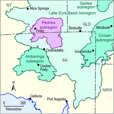
Groundwater is the most important and reliable water resource in the Pedirka subregion. These groundwater resources are mainly extracted from Jurassic to Cretaceous age aquifers of the Great Artesian Basin (GAB), which underlie most of the Pedirka subregion. Lesser volumes of groundwater are also extracted from other aquifers, such as those in the deeper sedimentary rock units of the geological Pedirka Basin, as well as near-surface sedimentary Cenozoic aquifers. The characteristics of the main aquifers of the Pedirka subregion are discussed in companion product 1.1 for the Pedirka subregion (Miles et al., 2015). Wohling et al. (2013) contains a comprehensive description of the geology and hydrogeology of the Pedirka subregion, including information on the main aquifer systems and groundwater flow characteristics.
In SA, all groundwater resources within the GAB and Far North Prescribed Wells Area (PWA) are subject to licence and allocation regulations governed by the SA Government’s Far North PWA Water Allocation Plan. From 2010 to 2011 the total licensed volume of groundwater extracted from the Far North PWA was about 62 GL (DEWNR, 2013). However, almost 80% of this licensed extraction was associated with petroleum and mining operations (including a special licence for the Olympic Dam mine), and none of these occur within the Pedirka subregion. Consequently, the actual volume of groundwater extracted from aquifers within the Pedirka subregion is presently not well defined; although most extraction is for pastoral water supplies, for example, stock watering (DEWNR, 2013).
In NT, all water resources (groundwater in all aquifers and surface water) that fall within the geographic extent of the NT GAB Water Control District are managed under the GAB NT Water Allocation Plan. Most of the NT part of the Pedirka subregion is covered by the GAB NT Water Allocation Plan (DLRM, 2013). Recent estimates of annual licensed and unlicensed groundwater extraction in this water allocation plan area are approximately 3.5 GL/year (Fulton, 2013).
Data and information required for a comprehensive analysis of water accounts for the Pedirka subregion are held in the National Groundwater Information System (NGIS) (Bureau of Meteorology, 2014). Further data and information on groundwater bores and licences is available from the SA Government’s WaterConnect website (DEWNR, 2015) and the NT Government’s Water Data Portal (DLRM, 2015a) and Water Licensing Register (DLRM, 2015b). The quality and coverage of information that would be required for a thorough understanding of the Pedirka subregion is of limited extent, but would ideally include:
- location, elevation and construction information for all groundwater bores
- geological logs of groundwater bores
- groundwater volumes held in aquifers
- groundwater trading volumes
- groundwater entitlements, allocations and use.

