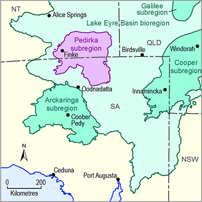
Surface water systems in the Pedirka subregion include the mid to lower part of the Finke river basin, the north-central part of the Macumba river basin and the lower floodout of the Hale river basin. However, most of the Pedirka subregion consists of arid sandy desert that lacks well-defined surface water drainage channels. The main exception to this is in the mid part of the Finke River, where valley-scale landforms may include discrete channel and floodplain zones, terraces and runoff slopes (Wakelin-King, in press). The Simpson Desert covers more than half of the subregion in the central and eastern parts, and the Pedirka Desert covers the south-western extent. All surface water systems in the subregion are ephemeral and unregulated. High intensity rainfall events are required for sustained surface water flow to occur, although the scale and extent of these typically vary across the subregion.
Due to the unreliability of surface water flows in the Pedirka subregion, they are not consistently relied upon as a water supply source for stock, agricultural or domestic purposes. Consequently, there are no current surface water allocations for the Pedirka subregion. All water allocations granted by the South Australian Government (SA Government) and the Northern Territory Government (NT Government) in this subregion relate to groundwater resources. Further information about surface water hydrology is outlined in companion product 1.1 for the Pedirka subregion (Miles et al., 2015). Wohling et al. (2013) also summarised the surface hydrology of the Pedirka subregion.
Some available data on surface water systems can be sourced from the SA Government’s WaterConnect website (DEWNR, 2015) and the NT Government’s Water Data Portal (DLRM, 2015a). Generally, the quality, extent and coverage of surface water data in the Pedirka subregion is sparse and inconsistent.

