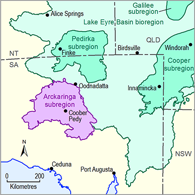
Groundwater is the most important water resource in the Arckaringa subregion. These groundwater resources are mainly extracted from aquifers of the GAB, although lesser volumes are also extracted from other aquifers, such as those in the deeper sedimentary rocks of the Arckaringa Basin, as well as various fractured rock aquifers and near-surface Cenozoic aquifers. The characteristics of the main aquifers are discussed in companion product 1.1 for the Arckaringa subregion (Miles et al., 2015). Wohling et al. (2013) provides a comprehensive description of the geology and hydrogeology of the Arckaringa subregion.
Groundwater in most of the Arckaringa subregion is managed by the SA Government under the Far North PWA Water Allocation Plan. However, some parts of the southern and western Arckaringa subregion occur outside of the Far North PWA within non-prescribed groundwater areas of the South Australian Arid Lands (SAAL) and Alinytjara Wilurara (AW) natural resource management regions. Consequently, the actual volume of groundwater extracted from within the entire Arckaringa subregion is presently not well-defined.
Despite the lack of specific information about groundwater extraction at the subregion-scale, it is possible to infer the main groundwater users in the Arckaringa subregion based on an understanding of allocations across the wider area of the Far North PWA. In 2011, the licensed allocation volume for groundwater extracted within the Far North PWA was about 47 GL (Department for Water, 2012). Over 70% of that volume is associated with petroleum and mining developments, although many of these do not occur within the Arckaringa subregion (as the boundaries of the Far North PWA extend much further north and east). One of the largest licensed allocations within the Arckaringa subregion is for the Prominent Hill copper-gold mine, which extracts about 6 GL/year of groundwater from a sedimentary aquifer system within the Arckaringa Basin. In addition to use for mining operations, groundwater is also extracted within the Arckaringa subregion for stock and domestic use, as well as town and camp water supply.
Data and information required for the water accounts for the Arckaringa subregion are held in the National Groundwater Information System (NGIS) (Bureau of Meteorology, 2014). Further data and information on groundwater bores and licences can also be sourced from the SA Government DEWNR WaterConnect website (DEWNR, 2015). Information that would be required for a more comprehensive understanding of the subregional water accounts (for example, to support detailed groundwater numerical modelling to investigate potential impacts of coal resource development on water resources) includes:
- location, elevation and construction information for all groundwater bores
- geological logs of groundwater bores
- groundwater volumes held in aquifers
- groundwater trading volumes
- groundwater entitlements, allocations and use, including groundwater for industrial use and town water supply.

