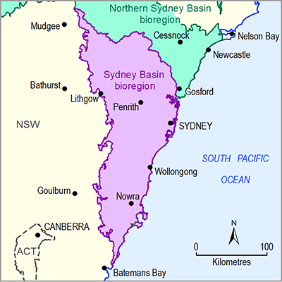
The total number of ecological assets in the asset database for the Sydney Basin bioregion is 1148 (Table 19) (Bioregional Assessment Programme, Dataset 1). These ecological assets fall within three broad subgroups – ‘Groundwater feature (subsurface)’, ‘Surface water feature’ or ‘Vegetation’ – and seven asset classes that are based on the type of water-dependent system within the subgroup (Table 19).
As described in Section 1.3.1.4, all landscape features such as aquifers, rivers, lagoons, lakes, springs and wetlands, and the habitats dependent on them, are inherently water dependent; hence, all assets in the subgroups ‘Surface water feature’ and ‘Groundwater feature (subsurface)’ are included in the water-dependent asset register. Selected ‘Surface water feature’ assets are illustrated in Figure 16 and Figure 17 and ‘Groundwater feature (subsurface)’ assets are illustrated in Figure 18.
Of the 961 assets in the ‘Vegetation’ subgroup, 477 assets are groundwater-dependent ecosystems (GDEs) (Figure 19) derived from the National atlas of groundwater-dependent ecosystems (GDE Atlas) (Bioregional Assessment Programme, Dataset 2). Of these, 14 are wetlands and 64 are rivers or creeks, which are by definition water dependent, and are classified as surface GDEs. Many of these are duplicates of assets within the ‘Surface water feature’ subgroup (e.g. Lake Illawarra). Of 397 ‘Vegetation’ assets classified as subsurface GDEs, 120 were included in the water-dependent asset register because they were identified as either ‘known GDEs’ or having a high probability of being a GDE. A further two known GDEs were supplied as assets by the NSW Office of Water based on occurrence of karst features (NSW Office of Water, Dataset 3). All 80 GDEs in the 'Vegetation’ subgroup classified as surface GDEs were determined to be water dependent.
The remaining 484 assets in the ‘Vegetation’ subgroup are classified as ‘Habitat (potential species distribution)’ and were derived from many sources (see Section 1.3.1). Of these, 364 were judged to be water dependent. Based on spatial overlap with other water-dependent landscape features, 24 of the 27 assets from the Collaborative Australian Protected Area Database (CAPAD) (Department of the Environment, Dataset 4) were judged to be water dependent, along with all Important Bird Areas (Birds Australia, Dataset 5) and all but one of the assets derived from NSW Office of Environment and Heritage (Dataset 6, Dataset 7, Dataset 8, Dataset 9, Dataset 11 and Dataset 15), NSW Department of Environment, Climate Change and Water (Dataset 10, Dataset 12, Dataset 14), and NSW Department of Planning and Infrastructure (Dataset 13). Selected assets are presented in Figure 20.
Four of the threatened ecological communities listed under the Commonwealth’s Environment Protection and Biodiversity Conservation Act 1999 (Department of the Environment, Dataset 16) were judged to be water dependent, including the ‘Temperate Highland Peat Swamps on Sandstone Threatened Ecological Community’. Of the 144 EPBC Act-listed species, 105 were judged to be water dependent based on their profiles in the Species Profiles and Threats Database (SPRAT) (Bioregional Assessment Programme, Dataset 17) and the NSW BioNet website (OEH, 2016). This included all fish (including sharks), turtles and frogs, 1 of 3 other reptiles (in addition to turtles), 50 of 51 birds, 6 of 8 mammals and 33 of 66 plants. The platypus was also included as a water-dependent asset. Because of the large number of these assets and their overlap, they are not presented in map form.
Of the 43 vegetation communities listed under NSW’s Threatened Species Conservation Act 1995 (TSC Act) (NSW Office of Environment and Heritage, Dataset 18), 21 were judged to be water dependent; of the 202 TSC Act-listed species, 151 were judged to be water dependent. Spatial layers for these assets were not available as of February 2016.
The three protected fish species (NSW Department of Primary Industries, Dataset 19, Dataset 20; Murray-Darling Basin Authority, Dataset 21) are clearly water dependent.
Table 19 Total ecological assets and water-dependent ecological assets in the preliminary assessment extent (PAE) of the Sydney Basin bioregion
Data: Bioregional Assessment Programme (Dataset 1)
Data: Bioregional Assessment Programme (Dataset 1)
Data: Bioregional Assessment Programme (Dataset 1)
Data: Bioregional Assessment Programme (Dataset 1)
GDE = groundwater-dependent ecosystem
Data: Bioregional Assessment Programme (Dataset 1)
Data: Bioregional Assessment Programme (Dataset 1)


