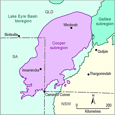
Coal occurs within the Permian rocks of the Tirrawarra Sandstone, Patchawarra, Epsilon, Daralingie and Toolachee formations of the geological Cooper Basin (Figure 4). Coal thickness and distribution maps for the Patchawarra and Toolachee formations are provided in companion product 1.1 for the Cooper subregion (Smith et al., 2015). In addition, coal seams have also been recorded in the overlying geological Eromanga Basin, particularly the Jurassic Birkhead Formation and Cretaceous Winton Formation. Lignite occurs in the Cenozoic Eyre Formation (Smith et al., 2015). Further information on coal classifications can be found in Appendix A.
There are no identified coal resources currently reported in the Cooper subregion (as per Australia’s national classification for mineral resources, see Appendix A). There are no coal mining tenements and only one exploration tenement in the Cooper subregion as the depth to major coal seams is greater than 1000 m, which is too deep for economic extraction.
The stratigraphy of the Cooper Basin is being refined by Geoscience Australia, SA and Queensland agencies. Where possible, this will be reflected in subsequent products for the Cooper subregion.
This figure has been optimised for printing on A3 paper (297 mm x 420 mm).

Product Finalisation date
- 1.2.1 Available coal and coal seam gas resources
- 1.2.2 Current activity and tenements
- 1.2.3 Proposals and exploration
- 1.2.4 Catalogue of potential resource developments
- Citation
- Acknowledgements
- Contributors to the Technical Programme
- About this technical product

